Hosdurg taluk
Hosdurg taluk | |
|---|---|
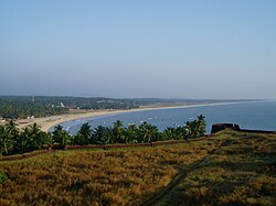
 Bekal Fort in Hosdurg Taluk | |
| Coordinates: 12°18′21″N 75°05′41″E / 12.3059°N 75.0947°E | |
| Country | |
| State | Kerala |
| District | Kasaragod |
| Government | |
| • Tehsildar | Premraj P |
| Area | |
• Total | 442 km2 (171 sq mi) |
| Population (2011) | |
• Total | 448,484 |
| • Density | 1,000/km2 (2,600/sq mi) |
| Languages | |
| • Official | Malayalam, English[1] |
| Time zone | UTC+5:30 (IST) |
| PIN | 671xxx |
| Telephone code | 0467 |
| Vehicle registration | KL 60 |
| Lok Sabha constituency | Kasaragod |
| Vidhan Sabha constituency | Kanhangad, Thrikaripur |


Hosdurg is one of four taluks that constitute the Kasaragod District, Kerala. Others are Kasaragod, Manjeshwaram and Vellarikundu taluks.[2] In the north, it borders Kasaragod taluk; in south, the Kannur District; in the east, Vellarikundu taluk; and in the west, the Arabian Sea. With an area of 900.3 km2 (90030 hectares), it was the smaller of the two taluks.[3] Then Hosdurg bifurcated into Vellarikund and Hosdurg taluks in 2013 for ease of administration.[4] Kanhangad and Nileshwaram are the municipalities within the taluk. Hosdurg (after which the taluk is named) is a kilometer south of Kanhangad town, the latter being the taluk headquarters. Other major settlements include Trikarpur, Cheruvathur and Udma. Bekal Fort tourism is situated in the taluk.
Etymology
[edit]The name Hosdurg comes from the word Hosa ("new") and Sanskrit word Durg ("fortress").
Demographics
[edit]As per the 2011 census, Hosdurg taluk had a total population of 625641 persons, which included 295,859 males and 329,782 females.[3] The literacy rate is 85.82%, higher than the national average.[3] In Hosdurg taluk, 12.42% of the total population is between the ages of 0–6 years.[3] Malayalam is the administrative language of the region.
Religions in Hosdurg Subdistrict (2011)[5]
Taluks of Kasaragod
[edit]
Constituent Villages
[edit]Hosdurg taluk has 31 revenue villages. They are ; Ajanur, Ambalathara, Balla, Bare, Cheemeni, Cheruvathur, Chithari, Hosdurg, Kanhangad, Kayyur, Keekan, Kilayikode, Kodakkad, Madikai, Maniyat, Nileshwaram, North Trikkarippur, Padanna, Pallikkara, Pallikkara-II, Panayal, Periya, Perole, Pilicode, Pudukai, Pullur, South Trikkarippur, Thimiri, Thuruthi, Uduma, Udinoor and Valiyaparamba.[6]
See also
[edit]External links
[edit]References
[edit]- ^ "The Kerala Official Language (Legislation) Act, 1969" (PDF). Archived from the original (PDF) on 20 April 2016. Retrieved 4 August 2021.
- ^ https://kerala.gov.in › docum...PDF Taluks in Kerala (as on 22-02-2018)
- ^ a b c d "Kasaragod district 2001 census". Archived from the original on 10 April 2009.
- ^ "Kasargod to get 2 more taluks".
- ^ "Religion – Kerala, Districts and Sub-districts". Census of India 2011. Office of the Registrar General.
- ^ "Taluk Offices". Retrieved 24 August 2021.


